
I arrived at the trailhead at 7 AM, and there was only one other car in the parking lot, even though multiple trails branch off from here. I was doing Mill Prong, Rapidan Camp, and Hightop Mountain via the Appalachian Trail.
We headed left on Mill Prong Trail, following the blue blazes. So far, just a small descent. Nothing major.
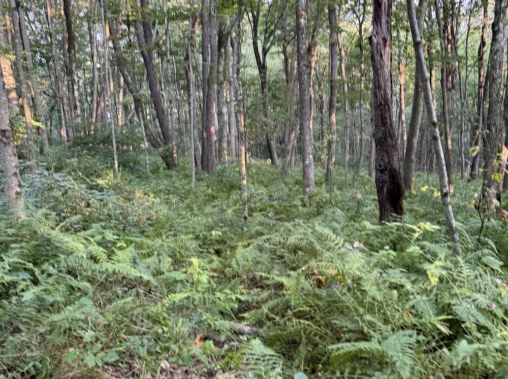
And almost immediately, you walk into this incredibly lush green forest.
Everything is green. Ferns everywhere, brush everywhere, just green and forest and lushness. It feels almost magical when you first walk in. Truly, truly beautiful.
Creek Crossings and an Easy Start
At about .7 miles, you’ll come across the first creek crossing. Because we’re in a drought, the water level was relatively low, and it was easy to cross by jumping over the rocks. The rocks are pretty big, though, so even with more water I don’t think this particular crossing would be too much of an issue.
So far, the trail was very nice and not particularly challenging.
At about 1.2 miles, there’s another water crossing. Again, nothing complicated. You’re also walking alongside the water for a bit, which is lovely. There are even a few places where you could probably get your feet wet if you’re hiking on a hot day.
The only people we’d come across at this point were some people camping along the trail. It was 7:51 AM, so still early, but so far this was definitely not feeling like one of Shenandoah’s more popular trails.
A Little Waterfall and an Easy-to-Miss Turn
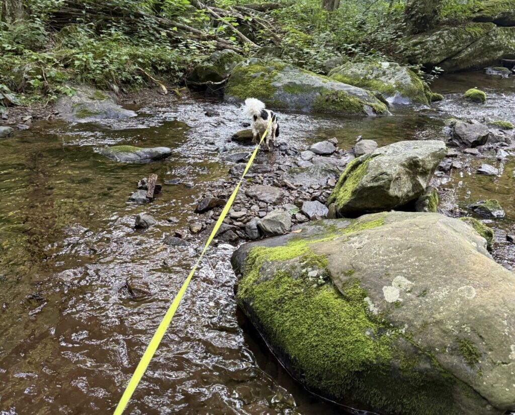
Around 1.7 or 1.8 miles, you’ll come across a little waterfall.
I let Zina go into the water, and Remi kind of went in, because apparently committing fully to the experience wasn’t necessary.
After the waterfall, you keep going, and there’s another creek crossing. As you will probably have guessed by now, there’s a theme happening here.
This particular crossing is easy to miss, though, so this is one area where you’ll want to pay attention. I almost didn’t catch where the trail continued.
Having a map downloaded from AllTrails has been incredibly helpful on many of my hikes for exactly this reason. There are trails where the route is obvious, and then there are places where you’re standing there looking around thinking, Well, where the hell did the trail go?
Download the map.
Rapidan Camp
At around two miles, you get to a bridge, and there are bathrooms, so if you need to go, now is your opportunity before heading back into the woods.
From there, you turn right and follow this little man-made trail.
At first I wasn’t entirely sure what was happening.
It’s cute.
Then there’s a house.
Turns out, we’d reached Rapidan Camp, the presidential retreat built for President Herbert Hoover.
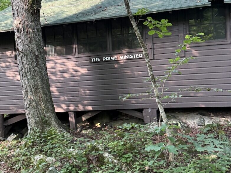
There are several buildings in this little historic area, including Brown House, the Prime Minister’s cabin, and Creel Cabin. It’s a really cute area to walk around and explore, especially if you’re interested in Shenandoah National Park’s history.
One of the houses is occupied by a park ranger, but otherwise I pretty much had the area to myself. I saw one other person who I think had been camping nearby.
For a Sunday, this was turning out to be a wonderfully quiet hike.
A Brief Review of My Waterproof Boots
I was wearing my Keen hiking boots, which are supposed to be waterproof.
And apparently they actually are.
They’re not the kind of waterproof that lets me stand in a creek for twenty minutes and test my luck, but I stepped into some water and my feet were still dry.
As far as whether waterproof boots are the best option for hiking, I don’t know. I do like the idea of my feet being able to breathe.
But I also really like not having to walk eight miles with wet feet.
So there’s that.
Welcome to Nettle Country
There are sections of this trail that are pretty overgrown, including plenty of nettles.
You are absolutely going to walk into them.
If you’re wearing shorts like me, you’re probably going to get stung.
But, you know, it’s a trail after all. I can’t exactly expect someone to come through the forest and clear every nettle out of my way.
By about three miles, with just over four miles supposedly left to go, I would have rated the trail easy to moderate depending on your hiking level. If you’re a regular hiker, the first few miles are probably going to feel pretty easy.
Around the three-mile mark, you switch from the yellow blazes back to blue and get onto the next section of the trail.
If You Like Walking Through the Forest, This Is Your Trail
If you like forest walking and you’re not dependent on having a big viewpoint or attraction every mile, this is a solid trail.
At four miles in, it had basically been nothing but forest.
And it was beautiful.
You can hear the birds everywhere. I hadn’t seen much wildlife as far as deer or anything else, but the birds were definitely present.
There were also some sections that were very overgrown.
Long pants would be useful.
Possibly a machete.
Between the nettles and the bushes, there were spots where maneuvering through became quite tricky, especially for Remi, my mini Bernedoodle. But overall, he did a great job getting through it.
There are also some really great camping spots along this route. If you wanted to turn this into an overnight trip or you’re backpacking through Shenandoah National Park, I saw several places that looked like they’d make great stops.
And Then Your Calves Notice the Mountain
Around the four-mile mark, I reached the beginning of an incline.
Nothing too terrible.
In fact, at first it’s almost not noticeable.
And then your calves suddenly decide to ask, What are you doing?
This is where I could see the trail moving more firmly from easy into moderate.
The other thing I noticed through here was the mushrooms.
So. Many. Mushrooms.
As someone who takes pictures of mushrooms constantly because they eventually make their way into my artwork, even I reached a point where the number of mushrooms was almost ridiculous.
I’d come around another section of trail, and there would be another mushroom.
And another.
And another.
Apparently Shenandoah had decided this was mushroom day.
What Goes Up Must Come Down. And Then Back Up.
What goes up must come down.
And then apparently you repeat that five or ten times.
The later stretch of this hike definitely gives you a workout. With about two miles left, there were some small rock scrambles and some sections that were a little challenging with the dogs in front of me, but we managed.
That’s really how I’d describe the difficulty of this entire loop.
It bebops between easy and moderate.
You’ll be cruising along thinking, Oh, this is nice, and then suddenly you’re climbing again.
Because we were hiking in July, everything was incredibly lush and green. That also means any mountain views you might otherwise have through the trees are mostly blocked by leaves. I imagine hiking this route during another season would open up some really nice views.
Eventually, the trail transitions into a more maintained single track and things settle down again.
The Appalachian Trail and the Final Miles
Around mile six-ish, things started getting relatively easy again, which was a nice change.
This isn’t necessarily a technically difficult hike, but the mileage combined with those repeated climbs and descents means you do need a decent level of fitness. You don’t have to be some hardcore mountain hiker, but being an active person will definitely help on some of these sections.
The last mile or so puts you on the Appalachian Trail.
And this section is lovely.
You’re back in the woods on this lush, easy single track, basically just walking.
Unfortunately, right around the seven-mile mark, my feet decided they were done.
So the final bit became a little bit of a struggle.
I’m pretty sure my dogs were ready to be at the car.
I was ready to be at the car.
And I was very ready to have my lunch.
Final Thoughts
The whole loop ended up being 8.38 miles, even though AllTrails showed it as somewhere around 7.4 miles.
That’s a fairly significant bonus mile when your feet have already decided they’ve completed the scheduled programming.
Overall, though, I really enjoyed this hike.
I’d rate it easy to moderate, with the difficulty coming less from any one major obstacle and more from the mileage, repeated inclines and declines, some small rock scrambles, creek crossings, and the occasional overgrown section trying to fight you.
There aren’t huge dramatic viewpoints around every corner. That’s not what this trail is.
This one is about being in the forest.
It’s water crossings, ferns, birds, mushrooms, nettles, old presidential cabins, quiet stretches of trail, and miles and miles of green.
And sometimes that’s exactly what I want from a hike.

Leave a Reply