

I started hiking at 8:30 a.m., parked at the trailhead, and had the place entirely to myself. No other cars. No noise. Always a good way to begin a loop.
The Milan Gap & Lewis Falls loop starts on a fairly easy single-track trail, nothing technical, nothing dramatic. If you’ve hiked Camp Hoover Trail before, parts of this route will feel familiar. The two trails share sections, and that overlap shows up early.
Early Miles: Easy, Familiar, and Quiet
Within the first mile, the trail stays gentle. You’ll pass Tanners Ridge Cemetery, cross a fire road just beyond it, and continue back onto the trail. Up to about 1.5 miles, the footing is solid with only a few blowdowns, easy enough to step over without breaking rhythm.
At around 1.73 miles, you’ll cross another trail. This is where direction matters:
- You can hike this loop clockwise
- I chose to go counterclockwise, which worked better for the dogs
It had rained the day before, so I was watching for slick leaves and hidden rocks. The trail wasn’t bad, but this is one of those hikes where paying attention matters; there are rocks tucked under leaves that could easily trip you if you zone out.
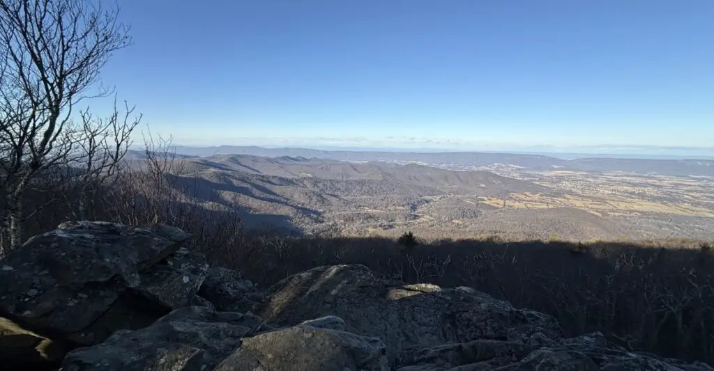
Mile 2.4: The Payoff View
Around 2.4 miles, you hit a beautiful overlook with a wide view into the valley and surrounding mountains. This is a great place to stop, snack, and breathe for a minute.
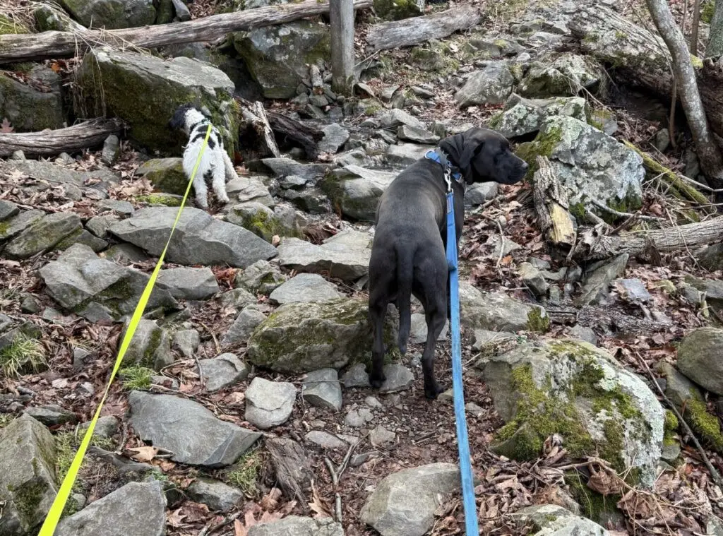
If you’re hiking with dogs, this spot requires a little extra attention; there are plenty of rocks and edges they’ll want to explore. Leashes are a must here.
Up to this point, elevation gain is mild. I’d call the trail easy to moderate, with nothing that demands serious effort.
Downhill Section & Trail Blazes
At about 2.7 miles, the trail shifts into its downhill stretch. This is also where you transition from white blazes (associated with the Appalachian Trail) to blue blazes.
If you want more of a workout, clockwise would give you more uphill. Personally, I prefer downhill first and steady effort later, and counterclockwise delivered that.
That said, downhill still requires focus. It’s not difficult, but it’s easy to misstep if you rush.
Dogs, Passing Etiquette, and Skipping the Waterfall
Near Lewis Falls, I chose to skip the waterfall platform. I was hiking with Milo, who is more reactive than Zina, and the tighter space plus foot traffic didn’t feel like a great setup.
We passed another couple with a dog, who kindly stepped off the trail to let us pass, something I deeply appreciate. Thoughtful trail etiquette goes a long way, especially when hiking with reactive dogs.
This hike reinforced why Milo is headed back into training. Managing dogs on trail takes awareness, preparation, and honesty about their limits.
Final Miles & Loop Completion
Around 4.8 miles, the trail trends uphill again, nothing brutal, but enough to remind you you’re still working. Even so, I’m confident counterclockwise was the easier overall choice for this loop.
At 4.65 miles, the loop portion ends, and you backtrack briefly toward the parking area. Despite the gravel underfoot, this section is still a trail, not a true fire road.
Final Stats
- Distance: 6.3 miles
- Time: 2 hours 43 minutes
- Difficulty: Moderate
- Crowds: Minimal (at least early)
Final Thoughts
This isn’t a flashy hike, but it’s a solid one. Good footing, a rewarding overlook, manageable elevation, and enough variety to keep it interesting without being exhausting.
Sometimes the best hikes are the ones that just work.


Leave a Reply